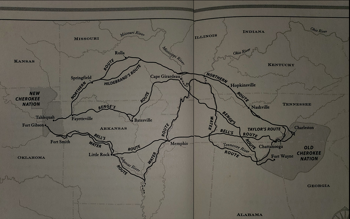

Most of the Cherokee people involved in the Trail of Tears took the Northern Route, marked in salmon-red at the top of the map. The utilization of horse drawn wagons was crucial to navigating the hills and straights of this 6-month long journey. This route ran from southeastern Tennessee across the state through Nashville and then through Hopkinsville, Kentucky; what is now Anna, Illinois; and Jackson, Missouri. The U.S. government favored this route for its simplicity and fairly secured perimeter.
A short distance into Arkansas some people broke from the main group and set out westward into what is now Oklahoma. This is the burial place of three men who had led a minority faction of Cherokee in favor of removal to Indian Territory. They were assassinated in 1839 by Cherokee that opposed the removal who deemed them to be traitors. An unfortunate consequence of the U.S. government’s decision to remove the Cherokee from their home, Civil War like tendencies appeared as groups splintered when favoring removal from their home lands.
The main group of Cherokee continued southward to Fayetteville, Arkansas. Over the span of a year, an estimated 12,000 Cherokee crossed the 800 mile Northern Route, making it the most used route of the Trail of Tears.