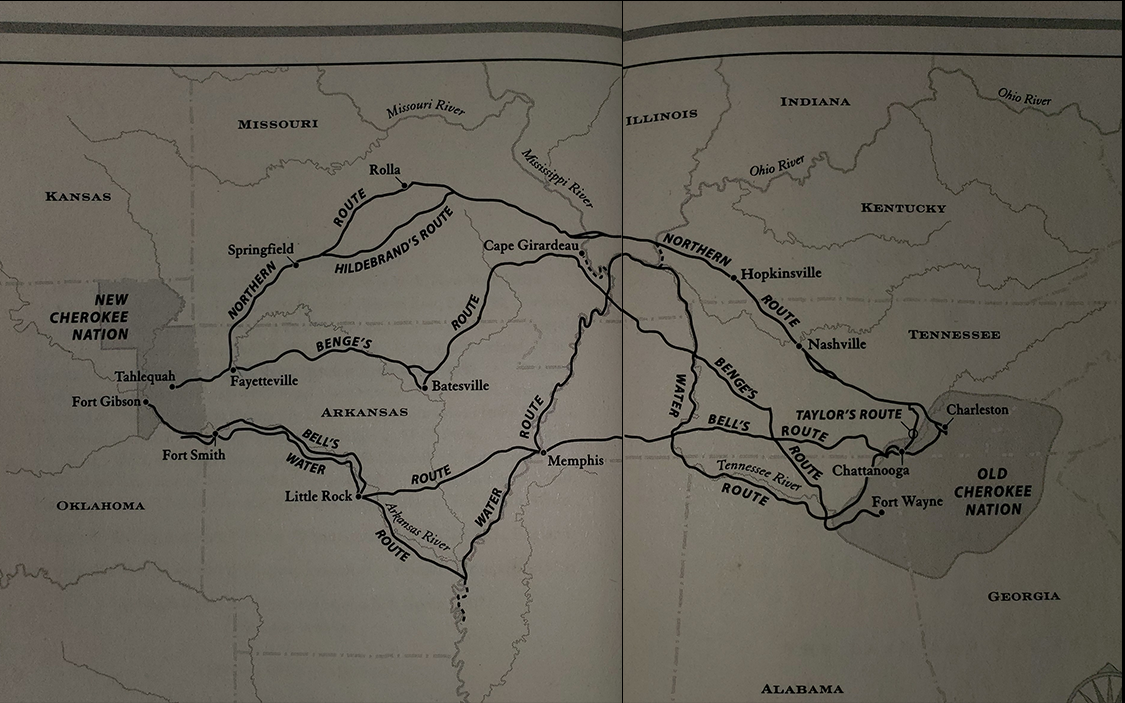

Another major land route, marked in yellow on the map, was that used by a Cherokee group in favor of migrating to Indian Territory. This route is named for John Bell, a white man who had married into the Cherokee and helped lead the group’s relocation. The route ran southwestward from the area of Fort Cass, Tennessee, to Ross’s Landing and then westward across the state through Pulaski to Memphis.
There it crossed the Mississippi River into Arkansas, where it passed south of what is now Wynne, ran southwestward to Little Rock, and then tended northwestward along the Arkansas River to what is now Russellville. From there it ran westward to Van Buren and then northward to Evansville. There the group dispersed into Indian Territory.

Image gathered from History.com