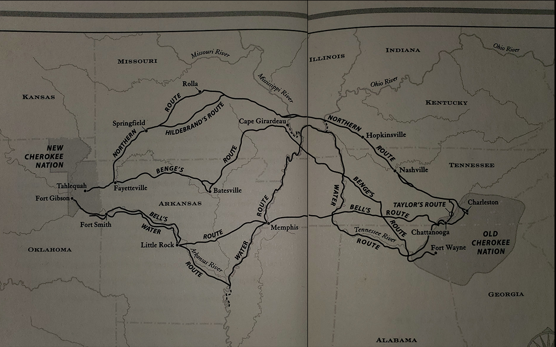

Before your eyes is the map depicting the Trail of Tears, a treacherous and forced journey of various Eastern Native American tribes as a result of the Indian Removal act of 1830. Over the course of a year, an estimated 17,000 Cherokee people were forcibly removed from their home to Indian Territory (now Oklahoma). Of those 17,000, an estimated 6,000 men, women, and children lost their lives due to various factors.
By hovering over the map or utilizing the navigation bar at the top of the map, you will take an informational journey through each area.
Each trail had its own purpose, whether it be for method of transportation or simple convenience for the U.S. government. Take your time, cycle back through information you might've missed, and remember those who lost their home, land, and lives.